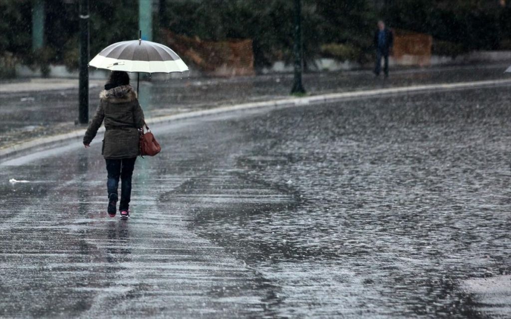
Bad weather continues today (16/12) with the rains and storms that have already hit most parts of the country intensifying over the next few hours.
At the same time, stormy north-easterly winds prevail in the north-east country and especially in the northern Aegean region.
Snow falls in the mountains and semi-mountains, as well as in the lower elevations of northern Greece. The temperature drop already felt across northern Greece will also occur in the central parts of the country and temperatures will drop by 6 to 8 degrees Celsius.
analytically
As per Emergency Deterioration of Weather Report issued by EMY on 14/12/2023/12.00 and updated as per latest forecast data:
A. Heavy rain and storms are forecast in the eastern country (mainly Sporades, Thessaly, Evia, northeast Aegean and possibly Halkidiki) until the afternoon, while events in the west will gradually decrease. Later in the afternoon, strong effects will be limited to the eastern Aegean and southern offshore-coastal areas and gradually weaken.
B. Snowfall is expected to continue in many places, in mountainous and semi-mountainous areas of central and northern Greece, while in eastern Macedonia and Thrace at lower altitudes (snowfall from about 200 m. ) is expected to decrease in the evenings.
C. A strong north-easterly wind will blow:
a) Today Saturday (16-12-2023) initially in central and northern Aegean, gradually from midday to Aegean 8 and locally 9 across Beaufort.
b) On Sunday (17-12-2023) there will be a stormy northerly wind of 8 Beaufort till noon in the northern Aegean and overnight in the central and southern Aegean.
D. Frost will occur in northern Greece over the weekend, becoming stronger inland in the northwest on Sunday.
Watch the trend of bad weather live
Region wise detailed forecast
According to the EMY, today, Saturday, December 16, is forecast to increase clouds with localized showers and storms over most areas.
In the eastern country, mainly in the Sporades, Thessaly, Evia, North-East Aegean and Halkidiki, events will be strong in places until the afternoon. Later in the afternoon, intense effects will be limited to the eastern Aegean and southern sea-coast areas and gradually weaken.
Temperatures will drop further mainly in central and northern regions
Snow falls in the mountains and semi-mountains of the central and northern countries, while the lower elevations of eastern Macedonia and Thrace also receive snow. Snow is expected to taper off in the evening.
Winds will be northeast, 6 to 7 in the west and 7 to 8 in the east and south and 9 beaufort in the central and northern Aegean inland.
Temperatures will drop further mainly in central and northern regions. In particular, it ranges from 00 to 08 in the north, 05 to 15 in the rest of the mainland, and 11 to 22 degrees Celsius in the island nation.
Macedonia, Thrace
Weather: Clouds with heavy rain and storms at places mainly in sea-coastal areas. Heavy snow will occur in mountainous and semi-mountainous areas in some places, while low-altitude areas (from about 200 m) in eastern Macedonia and Thrace will also experience snow. A lull in evening events.
Winds: 6 to 8 Beaufort from northerly directions and mainly offshore – 9 Beaufort inland in coastal areas.
Temperature: 00 to 08 degrees Celsius. 3 to 4 degrees lower in western Macedonia.
Ionian Islands, Epiros, West Styria, West Peloponnese
Weather: Clouds with rain and storms will prevail over continental areas during the first hours. There will be snow in the mountains. Slowdown of events in the afternoon.
Wind: Northerly 4 to 6 and inland Ionian to 7 Beaufort, gradually turning eastward with the same intensity.
Temperature: 07 to 15 degrees Celsius. In the interior of Epirus it is 5 to 6 degrees lower.
Eastern Styria, Evia, Eastern Peloponnese
Weather: Clouds with rain and scattered storms at many places, mainly in Evia. Snow falls in the hills and semi-hills. Slowdown of events in the afternoon.
Wind: North 5 to 7 and offshore – coastal areas inland 8 to 9 Beaufort.
Temperature: 05 to 15 degrees Celsius.
Cyclades, Crete
Weather: A few clouds will thicken quickly with localized rain and scattered thundershowers.
Winds: 4 to 6 southerlies gradually turning northerly to 6 to 8 and locally to 9 Beaufort in the Cyclades.
Temperature: 11 to 21 degrees Celsius.
Eastern Aegean Islands – Dodecanese
Weather: Rain and storms in the eastern Aegean islands, strong and snowy places in the northern mountains. In the Dodecanese, rain and scattered storms mainly from midday.
Wind: Southerly 4 to 6 and Northeast 7 to 9 Beaufort. Winds will be northerly at 4 to 6 Beaufort in the evening and south.
Temperature: 14 to 22 degrees Celsius in the Dodecanese. 05 to 12 degrees Celsius in North.
Thessaly
Weather: Heavy rain and storm at some places.
There will be snow in the mountains.
Wind: North 5 to 7 Beaufort.
Temperature: 04 to 10 degrees Celsius.
Attica
Weather: Cloudy with rain and heavy thundershowers in the morning. Snowfall in Barnita and Bendeley.
Winds: North 6 to 7 and East local 8 to 9 Beaufort.
Temperature: 05 to 13 degrees Celsius.
Thessaloniki
Weather: Cloudy with rain. There will be snowfall in the surrounding mountains. Improvement is expected from evening.
Wind: Northwest 5 to 6 Beaufort.
Temperature: 03 to 06 degrees Celsius.

. “Professional creator. Subtly charming web advocate. Unapologetic problem solver. Devoted student.”

-og.jpg?t=y7SX8xaU-xsaLEgDfmnp4A)


More Stories
B. Kigilias: Emergency meeting on civil defense due to multiple and simultaneous explosions
The number 1 of the gangster criminal organization “Contos” is in prison
Maroosee: Shooting outside nightclub – one dead, one injured