A new severe weather warning has been sounded for many parts of the country since Friday afternoon and is expected to last until midday on Sunday (5/11).
Already, severe weather category “P” has swept Achaia today Thursday and is expected to extend to other parts of the country from tomorrow.
Rain and storms will intensify on Saturday, with a risk of flooding.
High risk areas
Yannis Kallianos lists the high risk areas in his post. According to the meteorologist, the Ionian Islands, Epirus, Western Thessaly, Western Mainland, Central Western Peloponnese, Eastern Macedonia, Thrace and Northeast Aegean will receive the largest amount of water.
Severe lightning activity and heavy rain and thundershowers
“Rain and storms are areas of high intensity (probably even duration) and the risk of flooding is high. Lightning activity is very high in these areas and requires special attention from all residents”, Mr. Gallianos explains.
Also, in Central Thessaly, Western Macedonia and Central Macedonia, heavy rains and storms occur, but the amount of water that falls may be smaller than in the areas of the former category. And there is a risk of localized flooding in these areas,” the meteorologist points out.
At the same time, he notes that the eastern Peloponnese, the central and eastern mainland (including Attica), Evia, the Sporades and southeastern Thessaly will experience moderate rain events, but local storms will occur here and there.
Urgent report of bad weather from EMY
Weather will worsen with heavy rain and storms in most parts of the country from Friday (3/11) afternoon to Sunday (5/11) noon, initially accompanied by hail and high-frequency lightning. Northwest, gradually westward, northward with the extension of events toward the Northeast Continent, the eastern Aegean, and the Dodecanese. Winds blow strongly on seas.
More details:
A. Heavy Rain and Storms Forecast:
Friday (03-11-23)
A. From the afternoon in the Corfu-Paxos area.
B. Evening in Epirus and night in Western Styria.
Saturday (04-11-23)
A. In the Ionian Sea, Epirus, Western Styria, Western Peloponnese and Western Macedonia from the morning hours.
B. From noon in central Macedonia, eastern Macedonia and Thrace and the northeastern Aegean islands and temporarily Thessaly.
c. During the evening these events will weaken in most areas and will be limited to Thrace, the East Aegean Islands and the Dodecanese Islands.
Sunday (05-11-23)
A. Mornings in the East Aegean and Dodecanese Islands.
B. SATURDAY (04-11-23) Morning to afternoon winds of 7 to 8 in the Aegean region and 9 Beaufort inland.
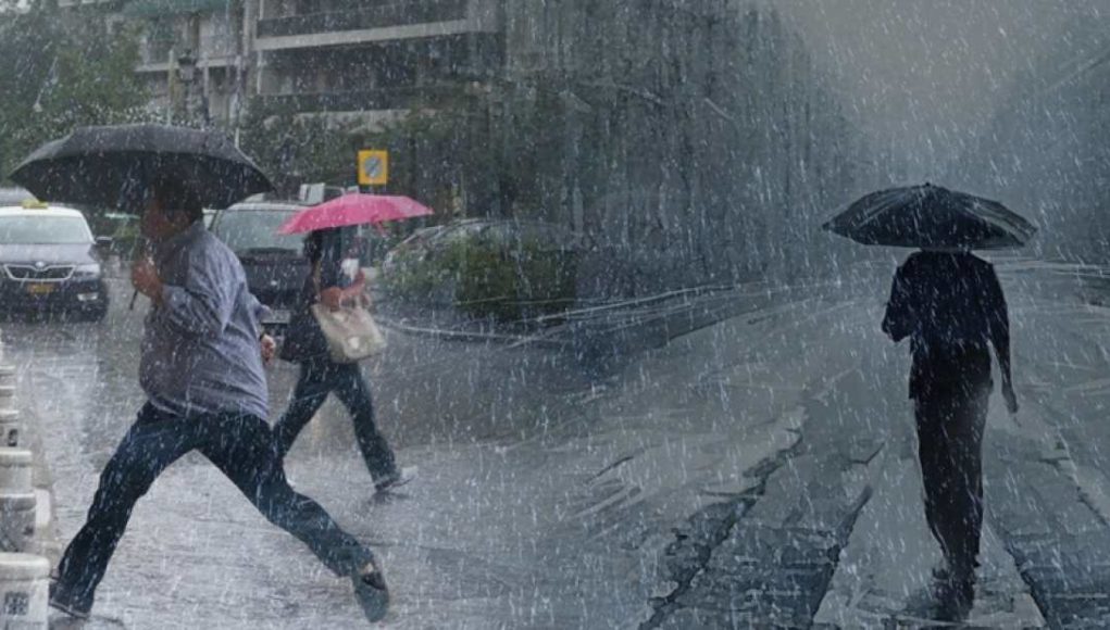
People holding umbrellas during the pouring rain
Recommendations of Chief Secretariat of Civil Defence
The General Secretariat of Civil Defense issues recommendations to citizens to be especially careful, ensuring that self-defense measures are taken against the risks posed by severe weather events.
In particular, in areas where heavy rain, storms or gale-force winds are forecast, the Public Health Service recommends that citizens:
* To protect items that may be damaged or injured if transported by severe weather.
* Ensuring that house drains and downspouts are unclogged and working properly.
* Avoid crossing streams and creeks on foot or by vehicle during storms and rains, but for a few hours after their occurrence.
* Avoid outdoor work and activities in ocean and coastal areas during severe weather events (risk of lightning).
* Take shelter immediately during a hailstorm. Take shelter in a building or car and do not leave a safe area until they are sure the storm has passed. Hail is also very dangerous for animals.
* Avoid going under large trees, posted boards and public places where light objects (eg pots, broken glass etc) can break and fall to the ground (eg under balconies).
* Strictly follow instructions of local authorities like traffic.
In areas with intense lightning activity:
If you are at home
* Do not hold electrical appliances or telephone as lightning can pass through electrical wires. Disconnect TV sets from antenna and power supply.
* Avoid touching plumbing pipes (kitchen, bathroom) as they are good conductors of electricity.
If you are in a car
* Keep away from roadsides and trees that fall on it.
* Stay inside until the storm passes and turn on the stop warning lights (emergency lights).
* Close windows and do not touch metal objects.
* Avoid flooded roads.
If you are outside
* Take shelter in a building or car or sit on the ground immediately without lying down.
* If you are in the woods, take cover under the sturdy branches of low trees.
* Do not take shelter under a tall tree in the open.
* Avoid low lying areas for flood risk.
* Do not stand near power poles, power lines, telephone lines and fences.
* Do not access metal objects (eg cars, bicycles, camping equipment, etc.).
* Stay away from rivers, lakes or other bodies of water.
* If you are in the ocean, get out immediately.
* If you are isolated on a flat surface and feel your hair stand on end (signaling that lightning is about to strike), drop the metal objects and sit with your head deep between your legs (lower body surface and contact with the ground). you have

. “Professional creator. Subtly charming web advocate. Unapologetic problem solver. Devoted student.”


More Stories
Where Political Leaders Celebrate Easter – Procession of Epitaphs and Pictures of the Procession (Photos)
The bombers take the device and activate it in the Gallidia cellar
Traffic accident in Piraeus: A 5-year-old boy is fighting for his life