In recent years, Google Maps has been enriched with a number of advanced features such as eco-friendly with low fuel consumption route finding and live view that helps guide when walking using augmented reality.
The new app updates announced by the internet giant take the next big step, which is incorporating AI functionality so the user can plan their trips more efficiently and make sustainable route choices.
Integrate AI into 80% of companies by 2026
Among the updates that are also of interest to Greece is the ability to search in a more intuitive visual way for various activities and experiences, but also improving the way search results are organized by grouping results by topic to make it easier to explore touchpoints and more. Activities.
In addition, the provision of information on traffic speed limits is also being expanded to Greece.
At the developer level and enabling them to create new solutions, new API updates are provided for places on the Google Maps platform, including EV charging information (where charging information is available). Photorealistic 3D tiles are also provided that run in GMP – unlocking high-resolution 3D images behind Google Earth so developers can build new experiences (also where GMP is available).
More detailed maps
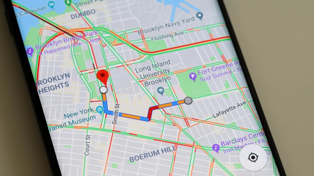
Google Maps already includes real-time updates describing actual road conditions, such as nearby accidents or upcoming traffic jams.
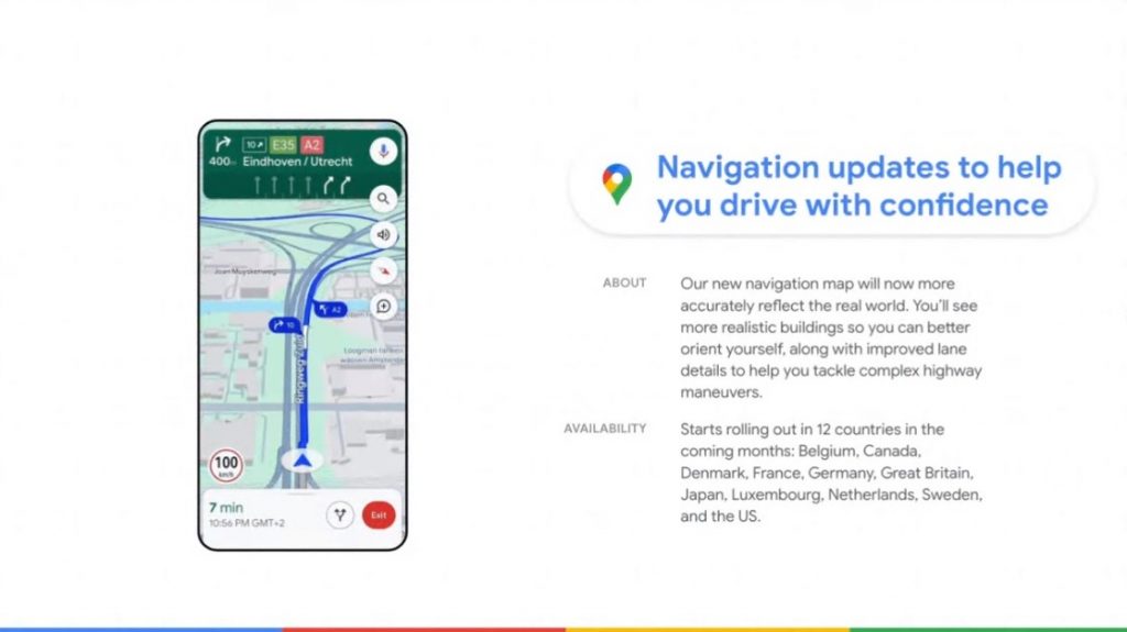
The next major change is that the navigation map will reflect the real world more accurately. In addition to updated colors throughout the map, the user will see more realistic buildings to better orient themselves.
In highway view, where some of the more difficult driving maneuvers often occur, enhanced lane detail is provided to better prepare the driver for upcoming lane changes.
These updates will begin rolling out in the coming months in 12 countries, including the United States, Canada, France, and Germany. In the US in particular, users will soon see route instructions in the app so they can make more informed decisions about how to get to their destination.
In Europe, AI-powered speed limit information is being expanded to 20 countries, including Greece, so drivers can stay safe even when speed limit signs on the road are difficult to spot. Both features will roll out to Android, iOS, and to Google’s built-in cars in the coming months.
Inspiration while driving
Search on Google Maps is evolving to answer more users’ questions and help them discover things and find inspiration in a whole new way.
As mentioned in the Google People online update, when you search Maps for specific things, like the best place to find “animal latte art,” you’ll first get results with images of what you’re searching for. These results are based on the analysis of billions of images shared by the Google Maps community, using artificial intelligence and advanced image recognition models.
Through this visual list of points of interest, the user will be able to discover new points that exactly match what he is looking for. Simply scroll through the results, click on the image to learn more, and then navigate there.
This new way to search on maps is rolling out in France, Germany, Japan, the UK, and the US starting this week, and will be rolled out to more countries (and Greece) over time.
Meanwhile, better organized search results come to Maps. The default scenario mentioned by the Google team wanted the user to be in Tokyo, where they would be able to do a “things to do” style search to see themed suggestions for places like “anime,” “cherry blossoms,” or “art galleries.” Click Click on the places you’re interested in to learn more, and save options to the list if you want to see them later.
Thematic results for activities and foods will be released globally (and in Greece) on Android and iOS in the coming weeks.
Understand the environment using Lens in maps
Google Maps will now make it easier to understand the environment once it reaches a point – such as when someone exits a subway station and needs to orient themselves. Focus on Maps (formerly Live Search) uses artificial intelligence and augmented reality to help you get acclimated quickly – whether you’re navigating a new city or discovering local points of interest.
The user will now simply tap on the Lens icon in the search bar and pick up their phone to find information about ATMs, transport stations, restaurants, cafes and shops nearby.
This feature was rolled out this week in more than 50 new cities, including Austin, Las Vegas, Rome, Sao Paulo, and Taipei.
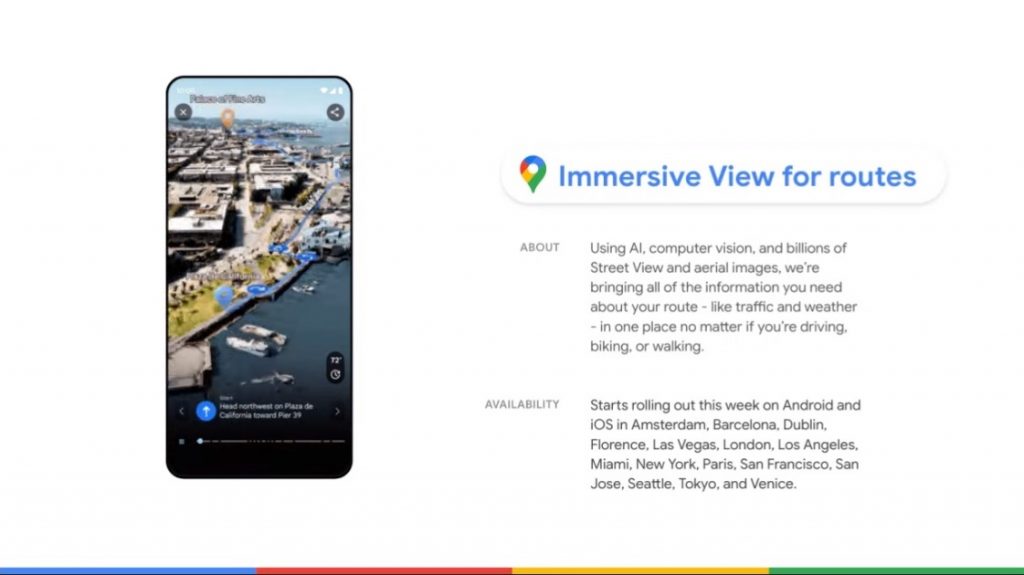
Familiarity with the immersive display of routes
According to what the company announced, with the use of artificial intelligence, the method of planning the trip is redefined before the driver takes off. At this year’s I/O conference, the American company already announced the global route view function, which is a completely new way to preview every stage of the journey – whether the user is driving, walking or using his bike.
Starting this week, the comprehensive route view will be available in Amsterdam, Barcelona, Dublin, Florence, Las Vegas, London, Los Angeles, Miami, New York, Paris, San Francisco, San Jose, Seattle, Tokyo and Venice on Android. and iOS platforms.
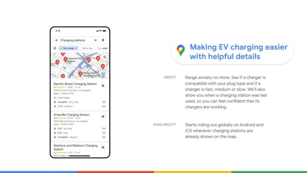
Electric vehicle charging information
If you’re an electric car driver, you obviously know the stress of charging. Whether you’re on a road trip, commuting to work, or driving across town, there’s nothing worse than not knowing where to charge your car battery.
Starting this week, with Google in Cars, electric vehicle drivers on Android and iOS will see more useful information about charging stations, like whether the charger is compatible with their car and whether the available chargers are fast, medium or slow to help you find a charging station. that best meets your needs.
Since approximately 25% of all chargers in the United States are broken at any given time, you can also find out when the charger was last used to avoid wasting time searching for a broken charger.
EV charging information will also be available to developers on the Google Maps platform in the Places API, so businesses can display real-time EV charging station information on their websites and apps.

“Avid problem solver. Extreme social media junkie. Beer buff. Coffee guru. Internet geek. Travel ninja.”


More Stories
Switch 2 reportedly replaces snap-on Joy-Con with magnetic one – Nintendo
Our Milky Way galaxy is a massive magnet that is being mapped in three dimensions for the first time
What are the black “spiders” in the “Inca city” on Mars? View satellite images