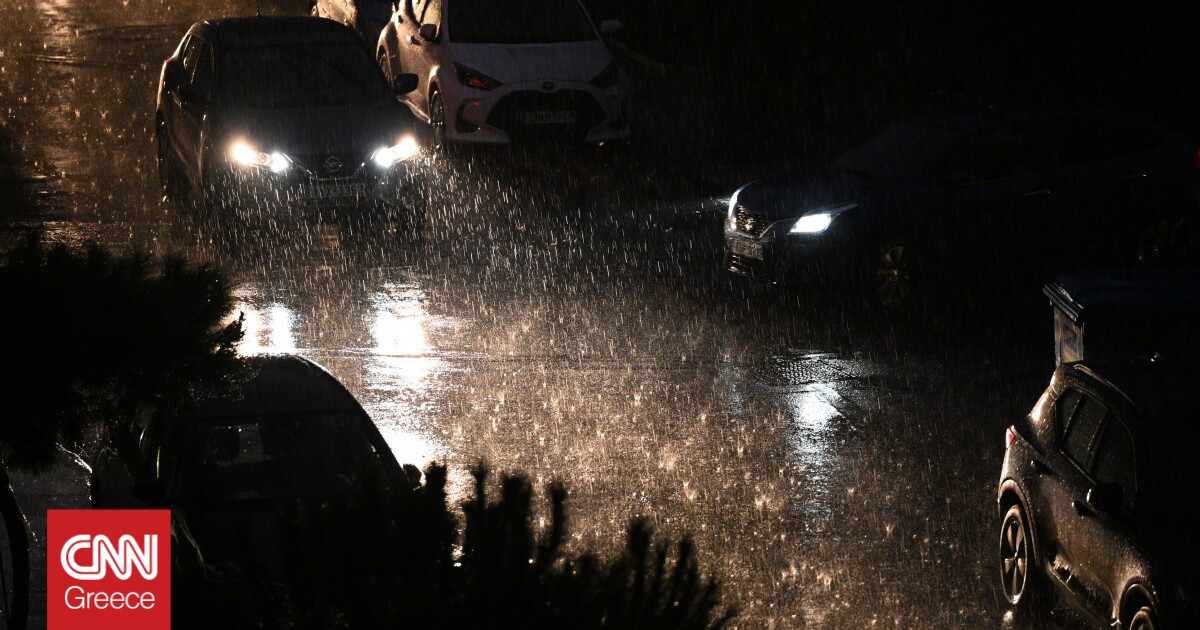
According to meteorologists, it is an extreme natural phenomenon, the main characteristics of the weather are heavy rains and storms, accompanied by hail and high frequency. of lightningStronger winds and a significant drop in temperature in the Aegean.
The night is expected to be difficult with storms, lightning and a significant possibility of flooding in mainland Greece. The Bad weather Daniel The regions of Ilia, Ionia, Thessaly and Phithiotida have already received the first wave and are expecting a second wave, which is rated as stronger and more dangerous.
A barrage of messages from 112
In particular, Message from 112 Sent to Thessaloniki on Monday afternoon (4/9). The warning is in effect for the next 24 hours from Monday evening. Also, via 112 a message was sent to Pieria, Thessaly, Sporades Evia and Fthiotida.
The first problems occurred in Lamia and Corfu as the already bad weather Daniel passed, while 112 was sounded in five regions, on Monday afternoon residents of Pieria, Thessaly, Sporades, Evia and Fthiotida received messages about dangerous weather events (strong storm-lightning). -Hail) from this evening till next 24 hours.
Which areas will be affected in the next few hours?
Residents in fire-hit areas are worried about flooding as more rain is expected.
In more detail, heavy rain and storms are forecast:
- Epirus, Ionian Islands, Western Styria and Western Peloponnese at times until late afternoon.
- Central Macedonia (mainly in the provinces of Pieria, Imathia and Halkidiki), Thessaly, Sporades, Central and Eastern Styria (mainly in the provinces of Evrytania, Fthiotida and Boeotia), Evia and the eastern and southern Peloponnese
- Sometimes in the province of Attica and western Crete
- Midday to evening in the western parts of the Cyclades and the northern Aegean islands.
her Wednesday 6/9/2023 Heavy Rain and Storms Forecast:
at ThessalyThe SporadesThe Central And Eastern continent (mainly in the provinces of Evrytania, Fthiotida and Boeotia), Evia (mainly in the north), eastern and southern Peloponnese and sometimes western and southern Crete.
These events will weaken in the evening except for Thessaly, Sporades and Northern Evia, where they are indicated to continue until Thursday morning.
Northeasterly winds of intensity 7 to 8 will prevail over the North Aegean from this evening to Tuesday 5-9-2023 evening, while temperatures will drop significantly by 6 to 8 degrees Celsius, mainly in the Ionian and Continental regions.
A storm in Athens too
According to the Meteo.gr forecast, a storm is also expected in Athens from midday on Tuesday (5/9).
In particular, the rain will start from 12:00 and a storm is expected at 15:00, the maximum temperature will not exceed 27 degrees.
More than 7,000 lightning bolts
The “ZEUS” lightning recording system of the National Observatory of Athens recorded more than 7,000 lightning strikes. According to a network of automated weather stations National Observatory of AthensMaximum rainfall recorded at Zagora Pelion till 18:30 is 103 mm.
High rainfall areas
A cold lake in the upper atmosphere combined with intense transport of water vapor from the Aegean to land is expected to bring heavy rain and storms to much of the country starting today. The National Observatory of Athens/Meteo.gr.
According to the latest forecast data, rains and storms, mainly in the central and southern regions, will be of intensity but duration, resulting in very high amounts of rain in the aforementioned regions capable of producing localized flooding events. .
The areas receiving the most rainfall are Thessaly (Magnesia, Trikala, Kurtitsa, eastern parts of N. Larissa), Sporades, Pyreia, Eastern Styria (Fithiotida, Boeotia), Eastern Peloponnese (Western Corinth, Argolis, Eastern). Arcadia) and southwestern Peloponnese (Messia).
Watch the bad weather unfold live:
Issues in Corfu, Patras, Lamia, Thessaloniki
At the same time, extensive damage has already been reported in many parts of the country due to Daniel’s severe weather. In particular, a strong typhoon hit Corfu around 3:00 p.m., resulting in tornadoes and lightning that caused problems in the electricity supply, as well as in the operation of the “Ioannis Kapodistrias” airport.
Due to intense lightning activity, 8 flights did not land and as per reports, at least three of them were diverted to nearby airports. Power went out in Corfu town and suburbs.
Flooding can be seen on Dimaion Beach in Patras, at the height of traffic lights in Antheas, with police officers rushing to the scene to ease traffic. At the same time, according to tempo24.news, a tree fell on Dymaion beach, Agios Andreas Heights, fortunately without any injuries. Fire department and police rushed to the spot.
Meanwhile, shortly before 3:00pm, an alarm was raised in Lamia that a car with a 43-year-old driver was swept away by the swift waters of Syria in Roditsa.
A torrential downpour earlier had flooded the stream which had been accessible earlier in the day, resulting in the driver being dragged several meters out of the water without realizing the danger.
He climbed onto the roof and the firefighters freed him, as you will see in his pictures lamiareport.gr:
Rthess and Kapani, the market in Thessaloniki, caused problems due to rain. The rain and the ongoing work made for a troublesome scene for the workers and visitors. In fact, to avoid accidents, wooden bridges were erected to connect the road with the entrances of the shops.

. “Professional creator. Subtly charming web advocate. Unapologetic problem solver. Devoted student.”


More Stories
Vervesos on iefimerida.gr: “Floridis Law” does not apply in the first instance to Mati
Weather: Local showers and thunderstorms today – forecast for Easter
Weather: Local showers and thunderstorms on Holy Wednesday